
Richmond History
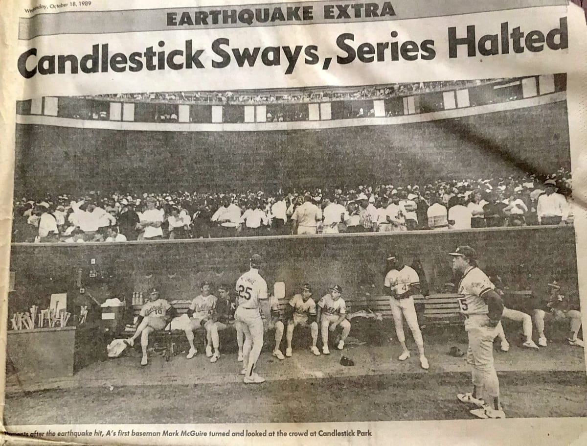
All eyes were on Candlestick Park on a warm fall day 35 years ago, with most of the Bay Area focused on game 3 of the World Series. The last thing on anyone's mind was an earthquake large enough to collapse a freeway and knock a section out of the Bay Bridge.
It's safe to say no one expected the proverbial "Big One" to hit during the much anticipated "Bay Bridge Series" with the San Francisco Giants squaring off against the Oakland A's. Still, at 5:04 p.m. local time, that's precisely what happened. The quake was a doozy: pegged initially at a whopping 7.1 in magnitude and later downgraded slightly, Loma Prieta was larger and deadlier than any earthquake most Bay Area people could recall, and those 15 seconds of shaking would change many things in the years to come.
Centered in Santa Cruz County, on a section of the San Andreas Fault, and with a magnitude of 6.9, the quake that shook the Bay Area caused 63 deaths, 3,757 injuries, and an estimated $6 billion in damage.
Loma Prieta caused significant damage to Oakland, San Francisco, and other parts of the Bay Area, leaving many communities without power or working telephones. With the internet still years away, communication in parts of Northern California came to a grinding halt.
In Oakland, the Cypress Street Viaduct collapsed, pancaking the top of the structure onto its lower level, instantly reducing cars stuck in evening traffic to squashed chunks of metal. The Bay Bridge's upper deck lost a section, separating the East Bay from San Francisco and stranding hundreds. Candlestick Park suffered damage to its upper deck as pieces of concrete fell from in front of dismayed baseball fans. As the sun went down, homes in the Marina District burned, ignited by leaking natural gas lines ripped apart from the jolt and its many aftershocks. Looking west from the East Bay, this was the only light visible in San Francisco.
No homes in Richmond collapsed, but many buildings, including the historic Ford Assembly Plant, were damaged. Everyone has a story to tell, explaining where they were on October 17 when the ground started to move.
According to the US Geological Survey, there is a probability of 72 percent that an earthquake measuring magnitude 6.7 will occur in the next 30 years in the San Francisco Bay Area.
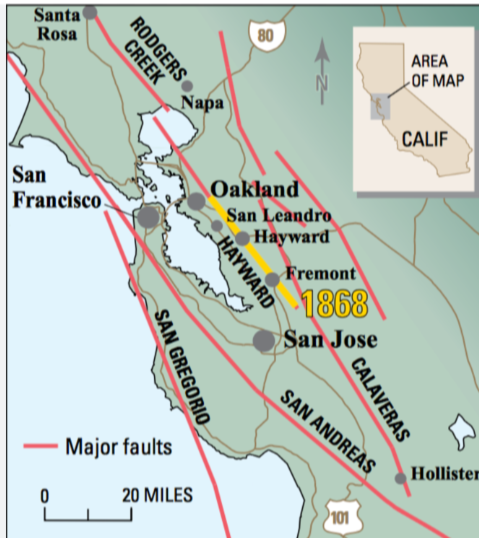
The Hayward fault runs through densely populated areas, including Richmond, El Cerrito, Berkeley, Oakland, San Leandro, Castro Valley, Hayward, Union City, Fremont, and San Jose. The San Andreas lies just west, cutting through the western part of San Francisco and down the peninsula.
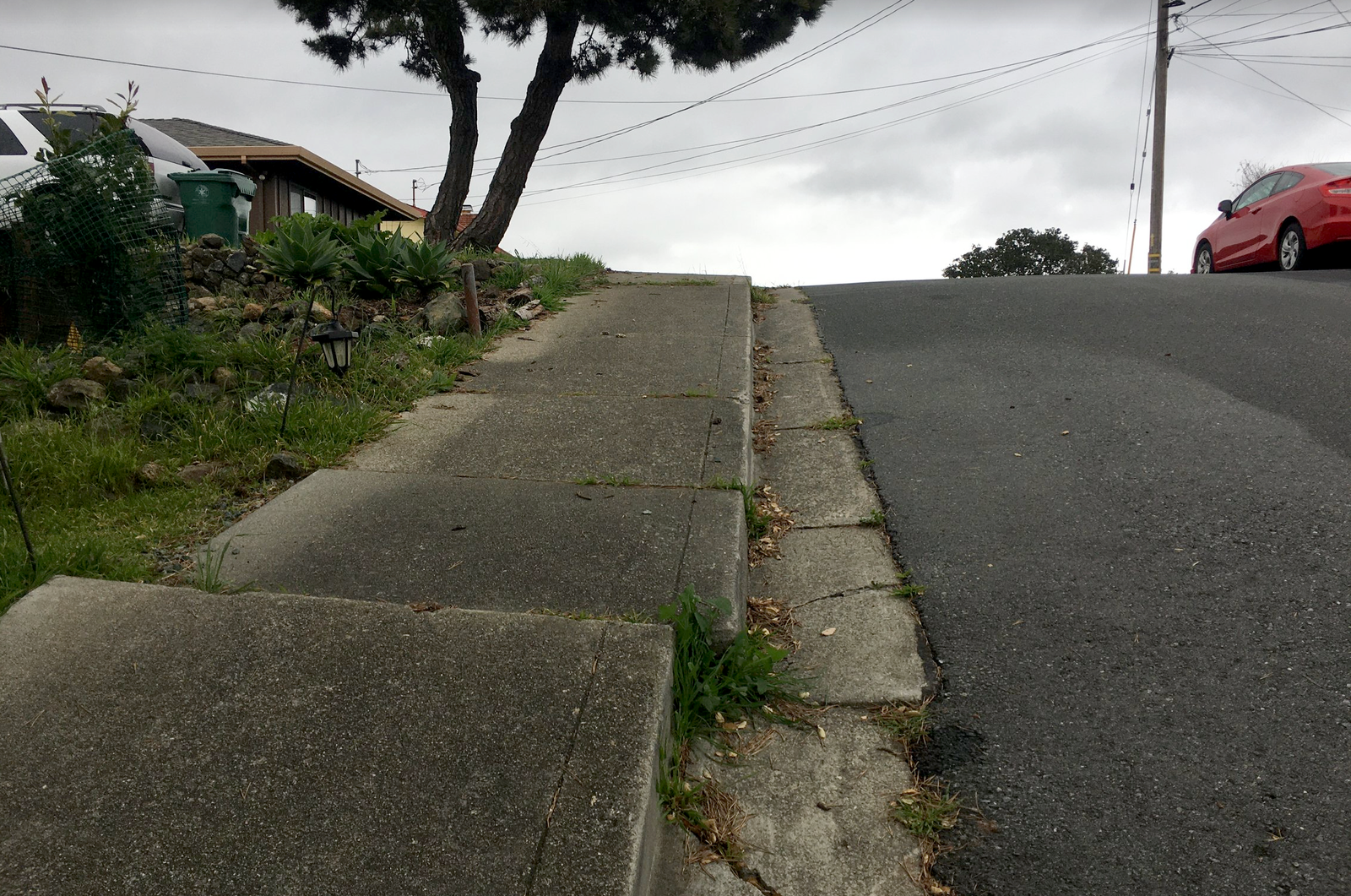
Evidence of seismic activity is easy to find in Richmond, one notable place being Alvarado Park. The fault line cuts through San Pablo's Riverside Elementary into the park and up Arlington Avenue to Bernhard Avenue, making the movement of earth and structures visible, especially to those living there. The area surrounding Adams Middle School is in an active fault zone, creating a dilemma about how the vacant school property can be used.
Neighbors, surplus land committee visit shuttered Adams Middle School
Neighbors concerned about the future of the Adams Middle School property joined the West Contra Costa Unified School District 7-11 Committee for a site tour Tuesday evening. The school, which has been empty since 2009, is one of four unused properties the committee will evaluate for the district. Over the
 Soren Hemmila
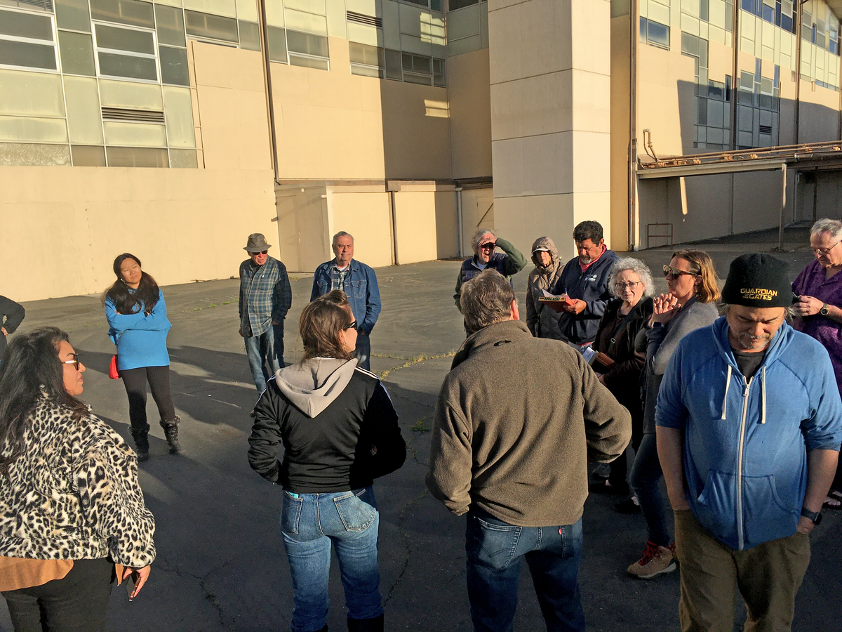
In the months and years following Loma Prieta, earthquake preparedness as we know it today was developed. While many people were already aware of safety basics, interest in preparedness grew, with more organizations and groups specializing in disaster training stepping up. Recently, apps developed to help predict seismic activity have become increasingly helpful.
MyShake is a mobile app developed by seismologists at UC Berkeley that uses smartphones as earthquake sensors, collecting data to alert users to an impending quake.
According to its website, MyShake is a citizen science project that connects users to build a global earthquake early warning network.
Home
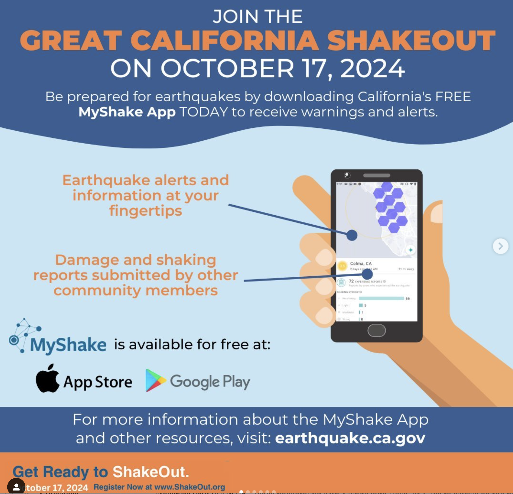
MyShake delivers ShakeAlert across California! Have earthquake information at your fingertips, see damage reports shared by citizen scientists like you, help us build a global seismic network. Earthquake alerts provided in partnership with USGS ShakeAlert and CalOES.

"Our app keeps you informed about earthquakes and monitors for them using data from your phone’s sensors. Our goal is to build a worldwide earthquake early warning network so that communities can reduce the impact of earthquakes," the website states.
Events like California's Great ShakeOut, where residents participate in earthquake drills at work, school, or home, also help promote earthquake awareness. This year's drill took place on October 17 at 10:17 a.m. – a nod to Loma Prieta.
In Richmond, two groups, CERT and REACT, specialize in disaster preparedness, including earthquakes. REACT/CERT training is accessible to any citizen, neighborhood, school, church, employee, or business in the City of Richmond.
To learn more, contact the Office of Emergency Services at (510) 620-6866.
Richmond Emergency Action Community Teams (REACT) | Richmond, CA - Official Website
 Government Websites by CivicPlus®
Help keep our content free for all!
Click to become a Grandview Supporter here, or make a one-time donation here. Grandview is an independent, journalist-run publication exclusively covering Richmond, CA. Every cent we make funds reporting from Richmond's neighborhoods. Copyright © 2024 Grandview Independent, all rights reserved.
Members Discussion